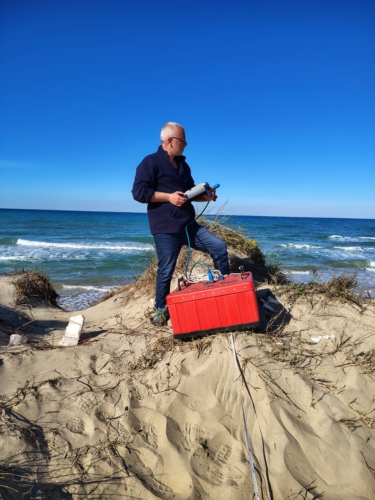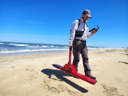
Electromagnetic methods:
Electromagnetic (EM) methods are widely used in environmental investigations to detect variations in electrical properties caused by geology, water quality, or contamination. A common application is site characterization, such as locating underground pollution sources, mapping spills, and tracking contaminant flow in groundwater (Fitterman et al., 1999; Paillet et al., 1999).
Time-Domain Electromagnetic (TEM) Surveys measure the Earth’s response to a rapidly switched magnetic field generated by a transmitter coil. When the current is turned off, induced eddy currents form in the subsurface and gradually dissipate. A receiver coil detects the changing secondary magnetic field produced by these currents (Nabighian & Macnae, 2001).
In high-resistivity sediments, eddy currents decay slowly and penetrate deeper.
In low-resistivity materials, currents decay faster.
TEM is effective for mapping conductive layers but less precise for high-resistivity zones (Sørensen and Auken, 2004).
However, TEM can be affected by metallic infrastructure such as fences and cables.
Frequency-Domain Electromagnetic Induction (FD-EMI) is similar in principle to TEM but uses a harmonic (continuous) electromagnetic field instead of pulses. The device emits a primary field that induces currents in the subsurface, generating a secondary field. The receiver measures both fields, separating them into:
The in-phase response (linked to magnetic susceptibility)
The quadrature response (related to apparent electrical conductivity, ECa) (Everett, 2013; Tabbagh, 1984).
FD-EMI’s resolution and penetration depth depend on the distance between transmitter and receiver coils: greater distances allow deeper penetration but reduce horizontal resolution.
Both TEM and FD-EMI have been successfully applied to hydrogeological problems. For example, Miller et al. (2002) combined FD-EM, GPR, and resistivity methods to map groundwater contamination at a landfill site.
Ground Penetrating Radar (GPR) is a high-resolution geophysical technique that uses electromagnetic (EM) pulses (10–1000 MHz) to detect subsurface features. It works by analyzing the scattering and propagation of EM waves, which are influenced by the dielectric permittivity and electrical conductivity of the material. High water content and conductive soils (like clay) can limit GPR effectiveness due to increased signal attenuation.
Low-frequency antennas (<100 MHz) penetrate deeper (up to tens of meters) but offer lower resolution. nHigh-frequency antennas (>400 MHz) provide finer detail (down to centimeters) but have limited depth (decimeters to a few meters). Combining data from different frequencies can improve results.
Essential for improving raw data quality, especially when low-frequency antennas are used, as they are more sensitive to EM noise.
GPR is widely used in the hydrogeoeological field, providing useful information for:
- Mapping aquifers and estimating moisture content.
- Describing fluvial and coastal deposits to reconstruct depositional environments.
- Studying sand dunes and coastal stratigraphy.
- Supporting glaciological research due to low EM wave attenuation in ice.
- Identifying coastal erosion, paleochannels, and saltwater intrusion.